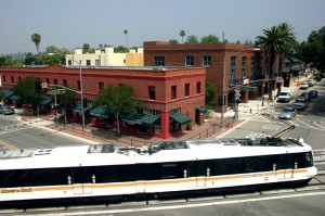
I’ll be a guest on KQED Forum today at 10am PT discussing congestion pricing — where cities charge drivers to enter congested areas during peak times, as a way to limit traffic and pay for transit. The show is part of Forum’s “In Transit” series where I’m a regular guest.
London, Stockholm and Singapore all use congestion pricing, but it has yet to be adopted in any U.S. city. Los Angeles is now studying the concept, and LA Metro will soon release a report examining which parts of the city could benefit most from congestion pricing.
Joining me on the show will be Mark Vallianatos, executive officer in the Office of Strategic Innovation, LA Metro.
You can stream live or tune in on KQED in Northern California.
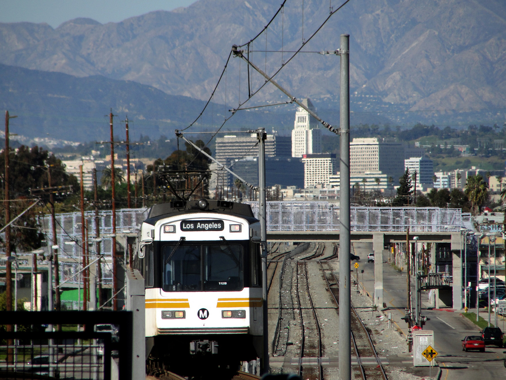
As transit ridership falls nationwide, many system operators are struggling to redesign their bus networks to be more responsive to where people actually want to go and when. And now they can use those pocket-sized surveillance devices known as smart phones to assist them.
Adam Rogers in Wired reported on a data-fueled effort at LA Metro to track transit riders via their cell phone data:
Cambridge Systematics, a transportation consultancy, acquired the kind of location information your phone continuously produces—from every app you didn’t say “no” to. The data was “hashed” so that researchers could connect geolocations (at a resolution of about 300 meters) to a device but couldn’t link the device to a phone number or a number to a person. Even with the resolution blurred this way, you can still discern a picture.
They found that commute times are still true, with two peaks between 7 and 9am and another between 3 and 6pm. No big surprise there. But they also found a third peak, from mid-day to about 9pm, as people run errands and see friends. The trouble is that this third peak coincides with a time period when traditional transit slacks off.
Furthermore, people are traveling outside of areas with the greatest population density and at shorter distances, contrary to how long-distance commuter transit lines are designed. Specifically, the cell phone data showed that “only 16 percent of trips in LA County were longer than 10 miles. Two-thirds of all travel was less than five miles. Short hops, not long hauls, rule the roads.”
The agency surmises that faster, more frequent bus service on these specific, well-traveled routes could potentially net more riders:
[The] team ran billions of cell phone-registered trips through the agency’s regional planner to estimate how long they would take on the transit system. Then they ran the same trips through Google Maps to see how long they’d take to drive. Some 85 percent of trips could be taken on mass transit, but fewer than half were as fast as driving. … But laying the fare card data alongside the larger set of phone logs showed that even if a trip took about the same amount of time, just 13 percent of travel on that route was by transit.
Clearly a bus system redesign based on where people want to go and when, and relying on faster service, will be crucial for success. But speeding up the buses (and making them more appealing than passenger vehicle trips) will require a change in land use priorities. That means more bus-only lanes and less publicly mandated and subsidized parking for private vehicles. And it also means congestion pricing to reduce traffic and provide revenue for transit alternatives.
While privacy advocates may have concerns about the methodology used in this effort, at least LA Metro now finally has a more accurate window into traveler preferences across the region. But we’ll likely need larger political changes to fully address the problem.

Map of the regional connector. Staging area was by the 1st and Central station on the right.
What’s a transit line without a tunnel? For densely populated areas, digging a tunnel can bring badly needed new capacity to congested corridors, while promising quick speeds underneath crowded roads. Plus tunnels represent interesting engineering and construction projects.
So when Jody Litvak of LA Metro invited me for a tour of the regional connector tunnel last spring, I jumped at the chance. At the time, the regional connector was under construction underneath Downtown Los Angeles, as you can see in the map above. I wrote about tunneling in Railtown, my book on the history of Metro Rail (I actually devoted a whole chapter to construction). But I’d never seen it up close until this tour.
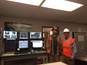
I met Jody and her team at the staging area near Alameda and 1st Street in downtown. Olga Arroyo helped arrange the details, Dick McClane was the lead tunnel operator, and Bill Hansmire, Gary Baker and Glen Frank came along for the tour. Dick helps control the tunnel boring machine from a command center that resembles a miniature air traffic control tower. He monitors and corrects the machine’s every moment, using a complex network of sensors.
Dick also helps oversee the workers who do the tunneling. They call themselves “miners” — not “tunnel stiffs,” as the original tunnelers called themselves who built Metro Rail back in the 1980s, as I wrote in Railtown. The work is not for everyone: the miners described to me how some first-time workers have panic attacks when they get in the tunnel and simply can’t do the work.
But the regional connector and other train tunnels are actually a luxury — in the tunneling world. Many tunnels they work on are tiny and go miles deep, such as for sewers or other pipe infrastructure. The workers have to journey in the whole way on a makeshift train, leaning over to speed through the narrow tunnel. By comparison, this was a big, convenient tunnel. But still, there’s no daylight down there, so it’s a challenging work environment, and the miners work long shifts — sometimes 24 hours, 5 days straight on multiple shifts (with downtime in between, of course).
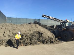
As the tour kicked off, safety was a priority. We were outfitted with helmets and reflective gear and instructed on proper procedures in the tunnel. Upon approach, the first thing we saw was the multi-block, fenced-off project site. The main feature was a conveyor belt from the shaft below, bringing up dirt that probably hadn’t seen the light of day in centuries, to be hauled off to help bury landfills. It created a huge pile that was actually just a couple days’ worth of excavation (see photo to the left).
The crew used this staging area to avoid disruption to the community from truck traffic coming out of tunnel. All that dirt requires a lot of vehicles to move it out of the area. In fact, truck traffic could be a limiting factor on tunnel boring, even if Elon Musk and his “Boring Machine” could speed the physical tunneling process.
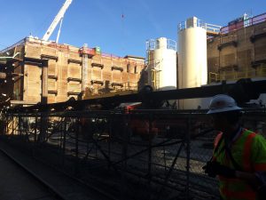
Also visible up above were stacks of preset concrete slabs to line the tunnels, along with temporary steel rails. The rails help bring materials in and out of the tunnel, as they are hoisted down by crane and brought into the tunnel by temporary rail cars to lay more track.
We then journeyed down from the staging area to the giant shaft in the shape of the eventual station box. It had steep, temporary stairs leading down to the future station bottom and tunnel entrance. At the bottom, we could start walking through the actual tunnel.
Getting close to the tunnel, we could see lots of utility lines through pipes above us, including an old aqueduct from original the original Pueblo settlement. As the workers told me, these “station boxes” are where they find all the archaeological finds. Otherwise, the boring machine pretty much grinds everything else up (although evidently the formation that the tunnel passes through doesn’t typically have archaeological finds). For more on the archaeological finds in the tunnel, check out this article.
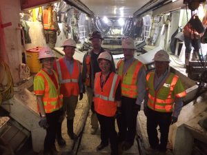
Inside the tunnel, it was hot with an odd smell. It was loud, too, particularly when workers dropped new 30-foot steel rails to the ground. The rails were needed for the temporary cars that brought in equipment. The tunnel boring machine (“TBM”) itself was probably about 100 yards long. In fact, it was so long, I was walking through it for a while without even knowing it.
The TBM is operated by four people: an operator, engineer, and mechanic, along with an MTA inspector. The machines have sensors everywhere and are extremely high-tech, monitoring the ground movement above. The software can automatically brake the TBM if the machine starts going in the wrong direction. The TBM uses pressure within the tunnel to maintain the pressure in the ground around the tunnel as it’s bored. That stabilization reduces, if not eliminates, both ground subsidence and gas seepage into the tunnel. For example, at the time of the tour, we were directly under a Japanese market in Little Tokyo. Hopefully, the patrons up above had no idea what was going on below. Sometimes TBM workers have to tunnel quickly through some parts of the city, like through certain soils that aren’t as solid.
Progress was steady: the miners were clearing about 80 feet in one day, at an average of 65 feet. They were starting with just the “left” bore for now, drilling it out for one mile, then hauling the tunnel boring machine (TBM) back to the project site and reassembling it for the “right” bore in the same direction, to create two tracks for the line. Overall, the first tunnel was set to take 5 months to go the whole 5,000 feet, 2 months to reassemble, and then another 5 months for the other tunnel.
In terms of cost, the tunneling represented only 10% of the total project cost. The station boxes are the other big chunk of change, particularly the future Bunker Hill stop, because it’s so deep.
Overall, it was an interesting opportunity to see digging in action. The project is scheduled to be finished in 2021. Once I ride it, I’ll end up whizzing through the section I walked. But I’ll now know how much work went into building it.
If you want more tunnel tour accounts, check out Curbed.LA from July and then again last month.
Falling transit ridership is a nationwide problem, but it’s particularly a setback in Los Angeles, which is investing like crazy in transit due to two recently passed transportation sales tax measures. Laura Nelson covered the recent ridership decline in the Los Angeles Times and what L.A. Metro plans to do about:
Metro bus ridership fell 18% in April compared with April 2015. The number of trips taken on Metro buses annually fell by more than 59 million, or 16%, between 2013 and 2016.
A recent survey of more than 2,000 former riders underscores the challenge Metro faces. Many passengers said buses didn’t go where they were going — or, if they did, the bus didn’t come often enough, or stopped running too early, or the trip required multiple transfers. Of those surveyed, 79% now primarily drive alone.
In an attempt to stem the declines, Metro is embarking on a study to “re-imagine” the system’s 170 lines and 15,000 stops, officials said. Researchers will consider how to better serve current riders and how to attract new customers, and will examine factors including demographics, travel patterns and employment centers.
Meanwhile, as Metro explains in its outlet The Source:
Metro has not embarked on such a systemwide effort since the 1990s so it is timely given the significant expansion of the Metro Rail system this century, growth of municipal operator services and the popularity of other transportation options (i.e. ride hailing services such as Lyft and Uber).
As I blogged earlier, it was easy to dismiss prior reports of falling ridership, but now is definitely a good time to take it seriously.
But Metro won’t exactly be hurrying to get to the bottom of this. The bus system review isn’t planned to be completed until April 2019, which will then require public hearings later that year. So any actual changes won’t go into effect until December 2019 — at the earliest.
Two years seems like a really long time to study this issue, although Los Angeles does have an enormous system. Still, a little urgency could be in order. And in the meantime, the agency could focus on one immediate step that is guaranteed to boost ridership: require local governments with major transit stations to relax restrictions on adjacent development.
And Metro could start with the recalcitrant neighborhoods around the new Expo Line.
Otherwise, we’ll have to wait a while on any results from the bus study.
 Measure M is one of the most promising ballot measures to pass in Los Angeles County in recent years. It offers $120 billion in long-term sales tax revenue to fund transportation projects — the kind of money that can help transform mobility in the region.
But the money brings perils, too, which I describe in a Los Angeles Times op-ed today:
If history is any guide, L.A. transit leaders have a habit of prioritizing politically expedient projects over ones that would benefit more riders. Faced with NIMBY opposition, our leaders too often cave.
Just look at the Expo Line from downtown L.A. to Santa Monica, a route that remains hampered by slow travel times after transit leaders failed to give the train priority over automobiles along city streets. Additionally, failure to push through with adequate development projects along the route denied this expensive rail technology an easy ridership boost.
Will transportation leaders similarly compromise away good Measure M projects until they go bad?
To answer this question, it’s important to understand what a “good” project entails. Cost-effectiveness — using the fewest dollars to move the most people the greatest distance — is key. Projects should attract maximal ridership, based on existing population, job density and service quality. Potential ridership, based on the feasibility of building more housing, retail and offices within walking distance of stations, is another crucial determinant. (The failure of the anti-growth Measure S in the recent L.A. election adds even more weight to this component.) Finally, projects should maximize reductions in overall driving miles, air pollution and greenhouse gas emissions.
The piece details some immediate tests facing Metro leaders and offers recommendations to ensure that they make smart decisions. The long-term future of LA in many ways will be determined by these short-term actions.
The Los Angeles Times ran my op-ed today on the politics behind the Gold Line extension to Azusa:
Back in 2008, rail boosters needed two-thirds support from Los Angeles voters for the sales tax increase for transportation known as Measure R — a threshold required by Proposition 13. The measure would fund important transit projects all around the county, from the Purple Line subway under Wilshire Boulevard to the Expo Line to Santa Monica.
San Gabriel Valley leaders argued that their region was being unfairly left out of the coming transit boom, and they repeatedly threatened to block the measure from even appearing on the ballot. In reality, they were always slated to get a gold-plated rail line. But Metro officials had to give the Gold Line extension priority in the funding plan in order to secure voter support along the route.
In some ways, the Gold Line extension is the price we all had to pay to secure funding for more cost-effective rail lines in densely populated parts of the county, which are now under construction.
Now that the Gold Line extension is operational, San Gabriel Valley leaders should be proactive about creating demand along the route. They should do everything they can to build more housing and offices near the stations — the optimal way to capitalize on the investment.
I can’t emphasize that last point enough. Now that we’ve spent the money on rail, San Gabriel Valley leaders must salvage the investment through more transit-oriented development.
Saturday was a day of celebration for rail fans in the San Gabriel Valley in Los Angeles. The Gold Line extension from Pasadena to Azusa opened, marred only by apparently long lines to get the return train home and then later by a big rig crash on the freeway that shut the whole line down.
But while some rail fans celebrate, I’ll have to be the Debbie Downer here. The Gold Line extension should not have been built as rail, and it was solely the result of a political compromise needed to fund rail in other more meritorious parts of Los Angeles County. It brings rail to a low-density part of the county that would be more economically served by bus rapid transit or even commuter buses running in the right-of-way, at probably 20 percent of the costs of rail.
From the beginning, as I documented in my book Railtown, the Gold Line from Union Station to Pasadena was motivated by politics more than ridership. Higher ridership lines in other parts of the county were bypassed because the Pasadena route had powerful political backers, from then-Mayor Riordan to Republican representative David Dreier, who offered critical bipartisan support for rail in the U.S. Congress because he wanted it to serve his district.
Then this extension came along. Why build rail here, in this low-density part of the county (see the video above to check out the lack of development along the route)? Back in 2008, rail boosters needed two-thirds support from the county voters for the sales tax increase known as Measure R. The measure would fund important transit projects all around the county, from the Purple Line subway to the Expo Line to Santa Monica.
But San Gabriel Valley leaders threw a fit, and they almost refused to authorize the measure for the ballot, using their allies on the county board of supervisors and in Sacramento to threaten to torpedo the whole thing for everyone.
Why? They felt that they weren’t going to get any projects out of the measure. But in reality, they were slated to get this gold-plated rail line, even though they didn’t deserve it. They were like hostage takers who wanted 100% assurance they’d get their ransom, and this line was it.
Eventually they came around, with much cajoling, and Measure R passed with over two-thirds support. But this project is the consequence of Prop 13, which requires these voter super majorities. Much compromise is required, and therefore some waste of public funds.
In some ways, the Gold Line extension is the price the region has to pay to have more cost-effective rail lines in densely populated parts of the county. And now that the rail line is up, hopefully local leaders will do everything they can to build more housing and offices near the stations. That’s the best (and only) way to salvage this investment.
And if that happens, then the real celebrating can start.
Reaction to the station area grades that Berkeley Law and Next 10 released this week has been mixed, with some transit leaders celebrating good scores and others reacting defensively. Part of the problem is that the media played up the overall transit system average grades, which weren’t great, and didn’t emphasize (or comprehend) that the grades were about the 1/2 mile station areas — not the stations themselves.
Over at the Los Angeles Metro, blogger Steve Hymon raised some interesting questions about the grades for Metro:
I think the results are certainly interesting although not terribly surprising — visiting any of the stations in person gives you a fairly good idea how they’re performing. And let’s face it: tossing 11 factors into a blender to come up with a letter grade only gets you so far: the Gold Line’s Chinatown Station on the edge of downtown L.A. gets an A, but the 7th/Metro Station in the heart of DTLA gets an A-. The Gold Line’s Mariachi Plaza gets an A (perhaps because there is a big employer, a hospital, nearby) but the Gold Line’s South Pasadena Station gets a C-.
The South Pasadena Station is busy and has helped revitalize Mission Street. As I’ve noted in the past, it hasn’t attracted a ton of residential development, although the number of parcels available nearby are limited. The area around the station is largely residential and I don’t think anyone wants or expects serious commercial development nearby. Parking is limited. To my eye, the the station has been very successful — but gets dinged here, presumably, because it’s not near a ton of jobs.
His comments are worth a closer look. First, the Chinatown station versus 7th & Metro. Steve is right that at first glance, the results seem odd. Chinatown gets an A but 7th & Metro gets an A-, even though it’s in the heart of the rail system as a bustling station.
So I checked the breakdown, and the scores were close. Ultimately Chinatown scored better on key metrics like affordability, safety, and transit dependency (number of zero vehicle households in the 1/2 mile radius). But the other factor is that the Chinatown station was competing against other station areas in the “mixed” category (mixed between employment and residential), whereas 7th & Metro was competing in the much tougher “employment” category. Stations in that category tend to be in high-density downtowns like San Francisco, so it’s more difficult to get a good grade. 7the & Metro came close to an A though and still finished in the top quartile statewide.
Second, I agree with Steve that the South Pasadena/Mission station on the Gold Line is a great station (photo above). It’s probably the prettiest and most well-designed in the system. So why did it get such a low score, with a C-?
The issue is not, as Steve suggests, about a lack of jobs or commercial development nearby. Instead, in looking at the data, the station area scored low because it was at the bottom for the percentage of people (workers and residents) within 1/2 mile who actually use transit. It also scored low for affordability in the area and for the percentage of people who don’t own a car. Otherwise, it scored well on transit quality, safety and walkability, among a few others.
So if South Pasadena leaders want to boost the Mission station score, they need to encourage people in the area to ride transit more. Certainly building more affordable housing nearby would help, as lower-income people tend to ride transit more often. And presumably the station will benefit from the opening of new lines like the Regional Connector and Expo, which might encourage more locals to ride transit to access more destinations.
But overall, the data reveal that the station area is not that competitive with other rail stations in its place type around the state. They also show that just building a few nice projects nearby is not enough to create a thriving, truly transit-oriented neighborhood. The neighborhood may be thriving, but not many people actually use transit.
Perhaps this station and others like it along the Gold Line, such as Del Mar, will benefit from a newer version of the report card. The 2010 census, on which much of the ridership data was based, does not capture the opening of new lines like Expo and the Gold Line eastside extension, and it doesn’t capture new transit riders moving into the neighborhood in the past few years.
But the data do not lie, and local leaders should explore ways to encourage more transit ridership in that station area if they want a better score in the future.
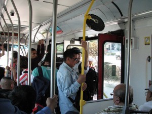 Ryan Reft at KCET looks at the history of the Bus Riders Union and the Los Angeles Metro, and how race and class issues have affected bus and rail transit:
In 1992, the Labor/Community Strategy Center (LCSC), under the leadership of Eric Mann and Manuel Criollo, formed the Bus Rider’s Union, a project aimed at drawing attention to the class and racial inequality at the heart of MTA transit policy. Both Mann and Criollo came to realize the impact of these inequities through their work fighting environmental racism for LCSC. While trying to organize residents in and around Los Angeles County they kept encountering the same issue: their constituents worried about local oil refineries and air pollution, but what impacted even more directly was their two to three hour commutes to work from places like Wilmington to the Valley or Los Angeles. “That was a transformative moment for us,” reflected Criollo years later. “The buses would have forty people sitting and forty people standing, no air conditioning, completely messed up … And on Metrolink, people were riding like Disneyland.”
The litigation risk for Metro’s rail transit program has faded since the 1990s, due to an intervening Supreme Court case that makes suing over discrimination harder. But the moral and economic case for prioritizing low-income transit riders remains. One easy step for Metro to address these challenges would be to lower bus fares. It’s a great way to boost ridership and help the people who truly need it.
Even without litigation, the racial and class dynamics will continue to affect Metro decision-making, particularly as economic inequality persists and worsens.

